See the exact point where a glacier, a lake and a river 'touch' in Argentina — Earth from space
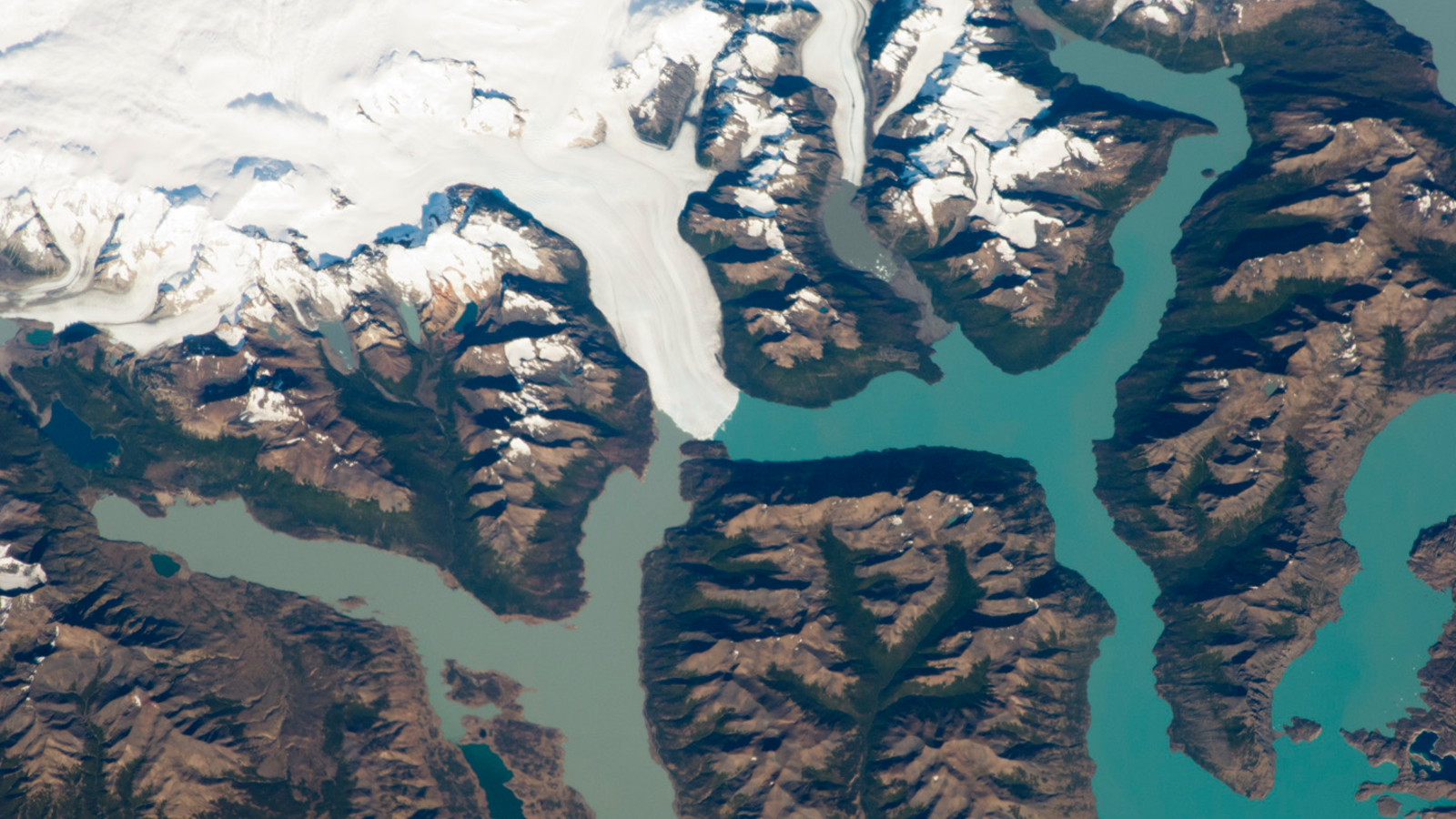
A 2021 astronaut photo shows a triple valley system in Argentina's Los Glaciares National Park where a massive climate-resilient glacier, a pristine turquoise lake and a murky green "river" come together at a single point.
An astronaut was able to snap the exact point where a glacier, lake and "river" touch at the intersection of three valleys in Argentina's Los Glaciares National Park. (Image credit: NASA/ISS program)
QUICK FACTS
Where is it? Los Glaciares National Park, Argentina [-50.469690266, -73.03391046]
What's in the photo? The point where a non-retreating glacier, a turquoise lake and a murky river meet
Who took the photo? An unnamed astronaut onboard the International Space Station (ISS)
When was it taken? March 2, 2021
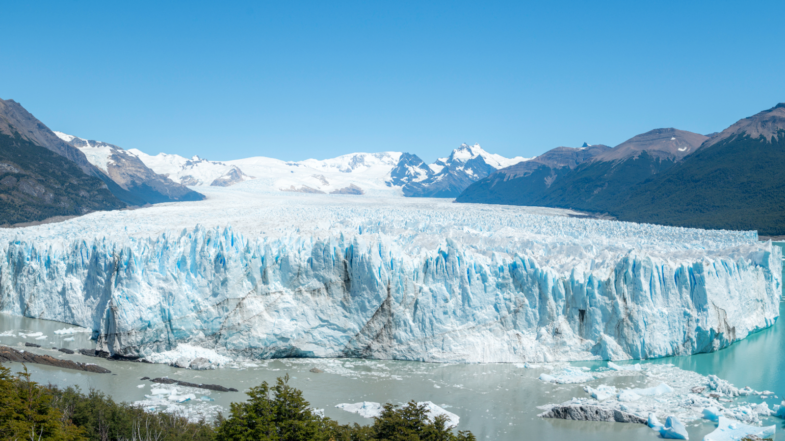
This incredible astronaut photo shows the unusual point where a hefty non-retreating glacier, a pristine turquoise lake and a murky green "river" perfectly converge at the intersection of three valleys in Argentina.
The trio of hydrological features — the Perito Moreno Glacier, Lago Argentino and Brazo Rico — lie at the heart of Los Glaciares National Park, which covers an area of around 2,300 square miles (6,000 square kilometers) in the Santa Cruz province of southern Argentina, near the country's border with Chile.
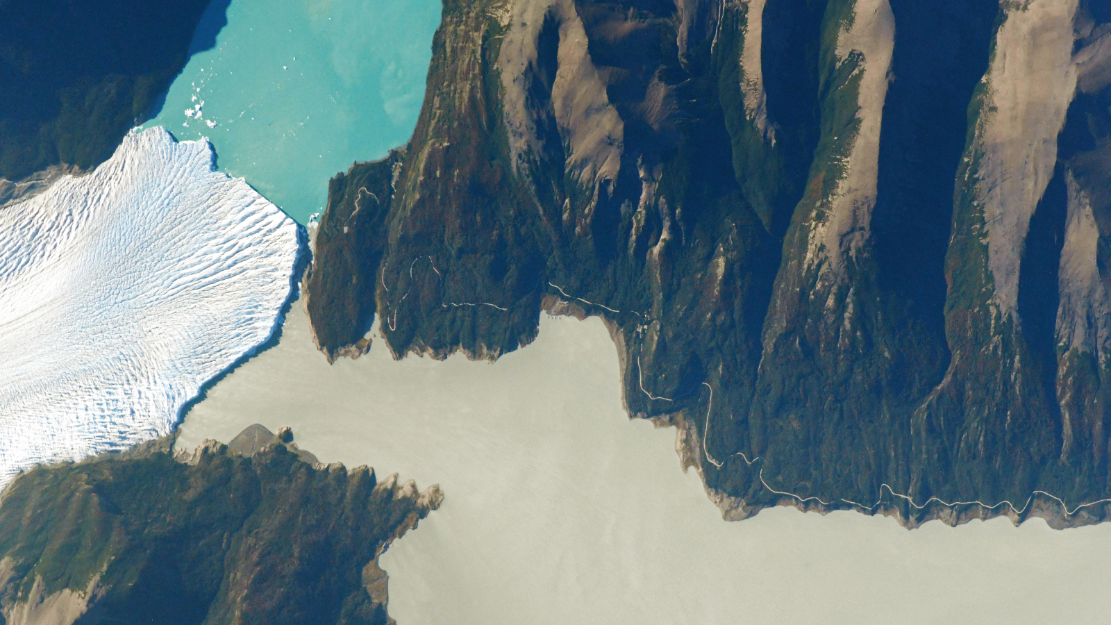
The aerial photo doesn’t just show off these three aqueous entities in a single frame; if you look closely, it also reveals the point where the trio touch in a slim channel along the western edge of the Magallanes Peninsula — the rocky outcrop that lies between the lake and the river, according to NASA's Earth Observatory.
In this photo, the waters of Lago Argentino and Brazo Rico are likely in direct contact with each other (as in the photo below). But their waters do not readily mix because they have different densities, due to their respective concentrations of suspended particulate matter, according to a 2022 study.
But every four to five years, the glacier's tongue juts forward, colliding with the Magallanes Peninsula and temporarily damming the Brazo Rico. When this happens, the surface of the murky body of water rises by up to 100 feet (30 meters) until a pressure build-up causes the icy dam to spectacularly "rupture," the Earth Observatory previously reported.